How to erase a lake?
Lake Drying Timelapse
Geographic Condition

Mexico City is located in an Endorheic Basin (Red Shape)
An endorheic basin is a region where the river network is completely isolated from the world ocean: the water flowing in the rivers never reaches the sea.
Source: “What is an endorheic basin and why are they so important ? | Géosciences Rennes.” n.d. Géosciences Rennes. Accessed April 16, 2024. https://geosciences.univ-rennes.fr/en/what-endorheic-basin-and-why-are-they-so-important.
Prehispanic Period 1325-1521

In 1325, the Aztecs founded Tenochtitlan on an island in Lake Texcoco surrounded by other lakes, where they found an eagle perched on a cactus eating a snake (the interpretation of this scene is the central image of the current Mexican flag).
The shield of the national flag is based on the legend that tells of Huitzilopochtli prophesying to the Aztecs during their migration from Aztlán that they should look for an eagle perched on a cactus in a lake with a snake in its claws. Upon seeing this scene, they founded the city of Tenochtitlán, current Mexico City.
The Valley of Mexico was made up of five ancient lakes:
1- Chalco
2- Xochimilco
3- Texcoco
4- San Cristobal-Xaltocan
5- Zumpango.
The city of Tenochtitlan was protected from floods by a large barrier (stone wall) built by Netzahualcoyotl in 1449, running from the Atzacoalco hill to Iztapalapa. The wall was 16 kilometres long and also separated fresh water from salt water. A
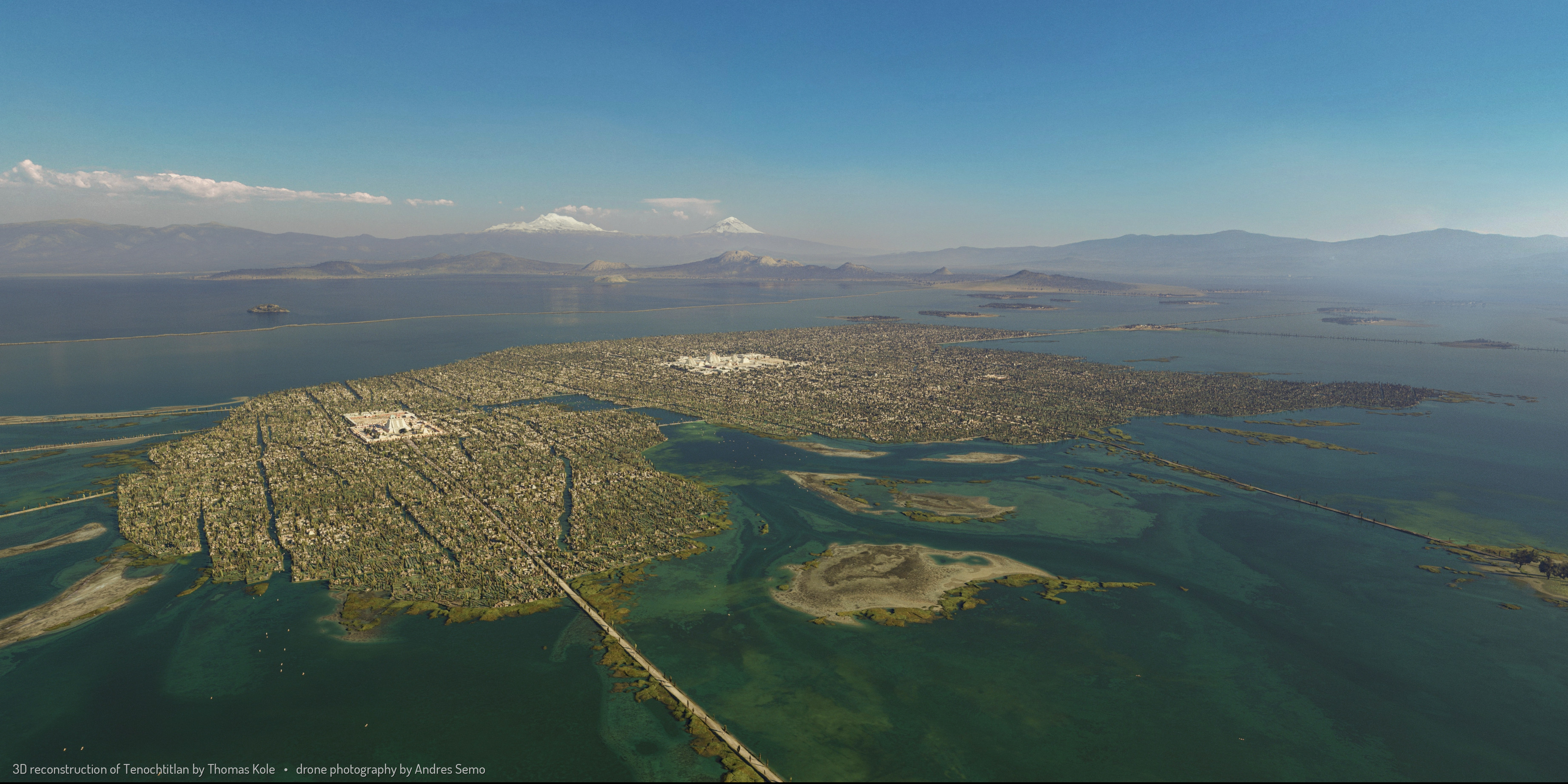

 Source: Thomas Kole
The greatness of Aztec civilization was based on the deep knowledge of water.
Their economic, cultural, and military strength came from their indissoluble relationship with such a vital element since they obtained food and protection from it.
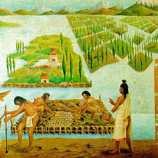
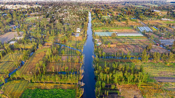
Image Source: The Construction of Chinampas (floating gardens) by José Muro Pico and is housed at the National Museum of Anthropology in Mexico City.
Image Source: UNAM
The Aztecs constructed the city center of Tenochtitlan by connecting existing islands through bridges and boardwalks through a technique called Chinampa.
Chinampa (Nahuatl language: chināmitl [tʃiˈnaːmitɬ]) is a technique used in Mesoamerican agriculture that relies on small, rectangular areas of fertile arable land to grow crops on the shallow lake beds in the Valley of Mexico. The geographical condition for its development is to be built up on wetlands of a lake or freshwater swamp. Its use can be for agricultural purposes, where their proportions ensure optimal moisture retention or housing.
The origin of this technique began when Tenochtitlan evolved into one of the most formidable cities in Mesoamerica though not without encountering construction challenges. As the Aztecs commenced their construction on the shores of Lake Texcoco, they encountered a significant hurdle: insufficient land for expansion. The landscape of the Mexico Valley was saturated with five lakes—Texcoco, Xaltocan, Zumpango, Chalco, and Xochimilco—along with diminutive marshy islands.
To solve their land crisis, archaeological findings and accounts from Spanish colonial writers, reveal a brilliant Aztec initiative: the chinampas. Chinampan was the ancient name for the southwestern region of the Valley of Mexico, the region of Xochimilco, and it was there that the technique was—and is still—most widely used. It consists of building several narrow islands, each averaging some 6 to 10
meters (20 to 35 feet) wide and some 100 to 200 meters (325 to 650 feet) long, using layers of vegetation, dirt, and mud. 12 The lake provides the chinampa with moisture-laden decomposing organic wastes that irrigate and fertilize the island’s soil, supporting an intensive and highly productive form of cultivation. While the Aztecs constructed the city center of Tenochtitlan by connecting existing islands through bridges and boardwalks, in peripheral areas like the Xochimilco lake basin, they utilized chinampas to establish buoyant gardens suitable for agriculture, animal husbandry, hunting, housing, and gathering. This innovative water-based farming technique empowered the Aztecs to sustain their burgeoning empire.
The geographical condition for its development is to be built up on wetlands of a lake or freshwater swamp. Its use can be for agricultural purposes, where their proportions ensure optimal moisture retention.

Source: Thomas Kole
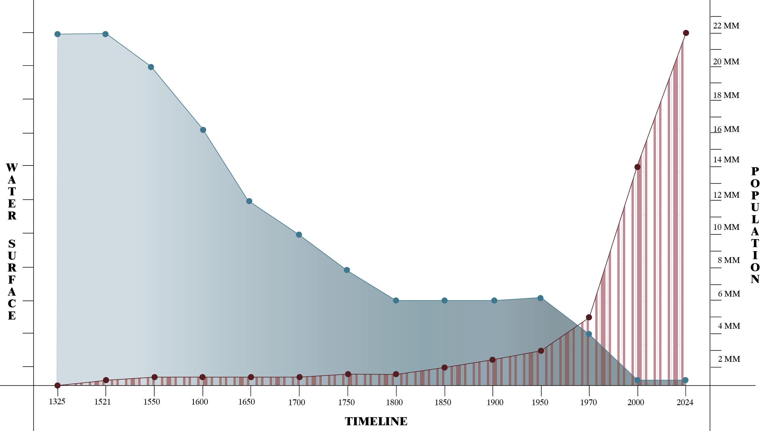
Drying Period 1521-1970
In 1519, 400 Spanish soldiers found a city over the water. Two years later, in 1521, the city was conquered.
The Spanish troops destroyed the pre-Hispanic temples. The imposition of a new religion was the religious military crusade of conquest. But to exclude the Indians from the Hispanic city was not enough to destroy the temples and their idols.
Suppressing lake culture was essential to ensure colonial domination.


Image Source: “La Plaza de las tres Culturas” Getty Images/iStockphoto
From this moment, the Spanish began to dry up the lake, and as a symbol of domination and conquest, they built the new city over the remains of the Aztec ceremonial buildings.
After the conquest, the drying of the lakes began, along with the destruction of the pre-Hispanic settlements on the shores of the lake.
The destruction of the pre-Hispanic hydraulic works caused floods, which have been the city's number one scourge ever since.
After the conquest, the drying of the lakes began, along with the destruction of the pre-Hispanic settlements on the shores of the lake.
No longer having direct access to a freshwater lake, the city was fed drinking water from the Magdalena River.
The water the conquerors could not understand had to be suppressed. Thus, the canals were converted into drains, and the water from the lakes became garbage deposits.
A canal was dug and built with two functions: to remove drainage from the city and water from the lakes.


Photo Source: “Tajo de Nochistongo 1825” W.H.Jackson
Image Source: Foro Metropolitano. El reto: primero el agua. www.aldf.gob.mx
The drinking water from the Magdalena River needed to be increased due to the growth of the population, and drinking water from Lake Xochimilco began to be consumed.
The drinking water from the Magdalena River needed to be increased due to the growth of the population, and drinking water from Lake Xochimilco began to be consumed.
The lakes continue to shrink, draining through the channel to the north.
Overpopulation Period 1970-2024

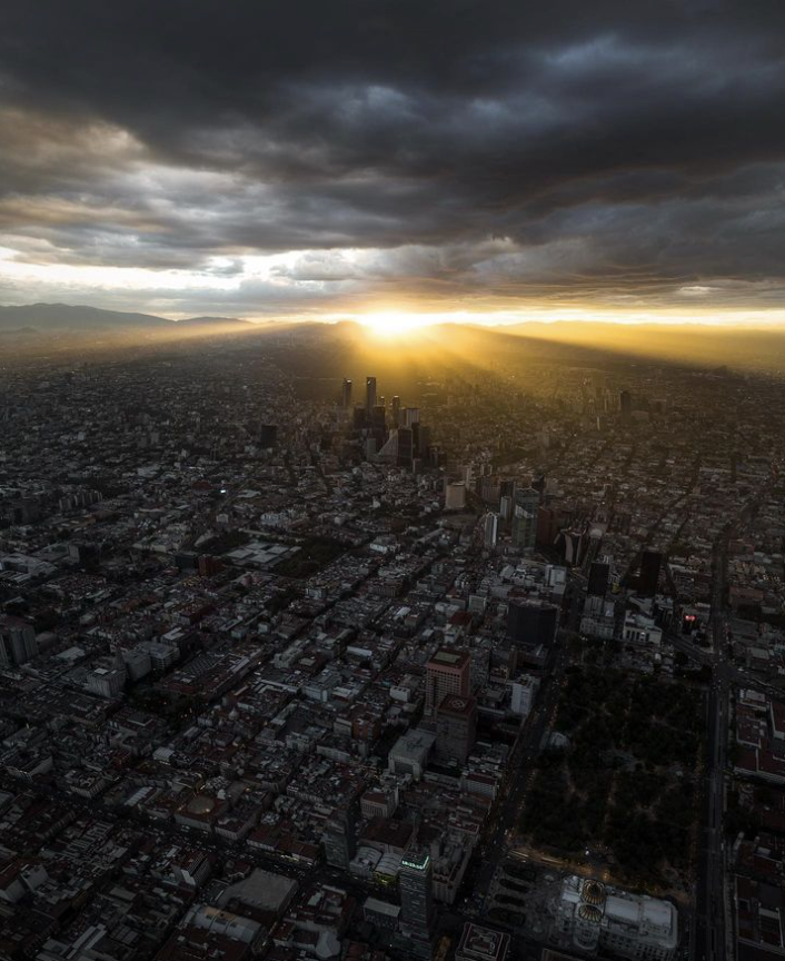
Source: Santiago Arau
The population grew, making the Magdalena River and Lake Xochimilco inefficient, and the Cutzamala system, which comes from a series of dams outside the basin, is built.


Source: El Economista
Source: ADN 40
Lake Xochimilco disappears as a source of drinking water.
Canals are increased to the north to remove rainwater, mixed with the city's drainage.
Lake Xochimilco disappears as a source of drinking water.
Canals are increased to the north to remove rainwater, mixed with the city's drainage.
Given the uncontrolled population growth and the lack of regulation of natural elements, only small bodies of water remain.